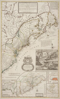
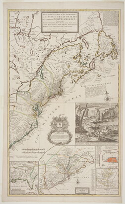
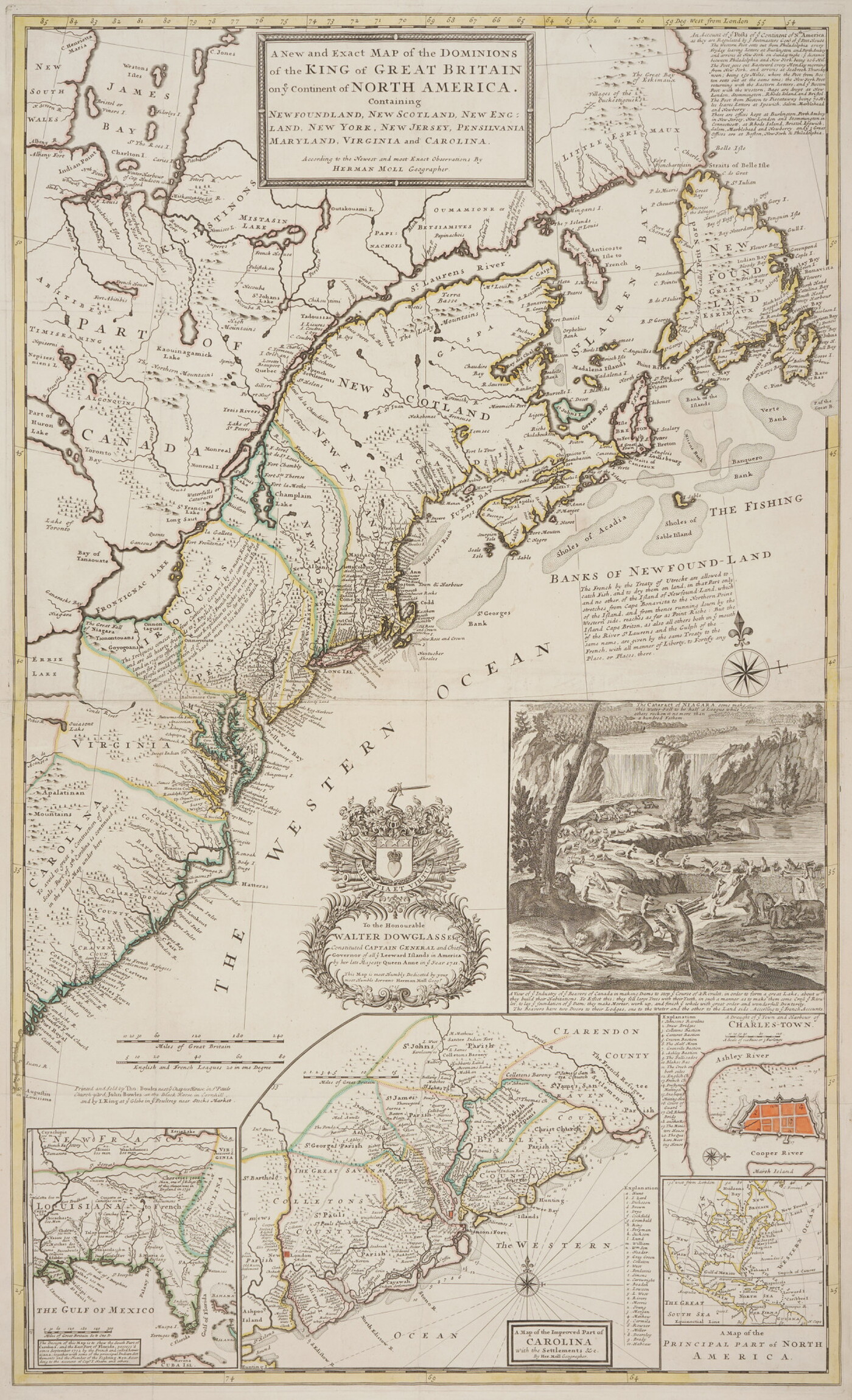
A New and Exact Map of the Dominions of The King of Great Britain on Ye Continent of North America.
Object Details
-
Date
1715
-
Object Type
Prints
-
Medium
Engraving with applied watercolor
-
Dimensions
40 x 24 1/4 in.
-
Inscriptions
Recto:
u.c.: A New and Exact MAP Of The DOMINIONS \ of The KING of GREAT BRITAIN \ on ye Continent of NORTH AMERICA. \ Containing \ NEW FOUNDLAND, NEW SCOTLAND, NEW ENG- \ LAND \ NEW YORK, NEW JERSEY, PENSILVANIA [sic] \ MARYLAND, VIRGINIA and CAROLINA. \ According to the Newest and Most Exact Observations BY \ HERMAN MOLL Geographer.
u.r.: [descriptive account]
c.: To The Honourable \ WALTER DOWGLASS Esqr. \ Constituted CAPTAIN GENERAL \ and Chief \ Governor \ alley Leeward Islands in America \ by her late Majesty Queen Anne in ye year 1711. \ This Map is most Humbly Dedicated by your \ most humble servant Herman Moll Geogr. \ 1715.
c.r.: [descriptive account]
l.l.: [descriptive account]
l.r.: [descriptive account; descriptive keys 1-20, a-z, 1-10]
-
Credit Line
Amon Carter Museum of American Art, Fort Worth, Texas
-
Accession Number
1964.119
-
Copyright
Public domain
Additional details
Tags
Amon Carter Disclaimer
This information is published from the Carter's collection database. Updates and additions based on research and imaging activities are ongoing. The images, titles, and inscriptions are products of their time and are presented here as documentation, not as a reflection of the Carter’s values. If you have corrections or additional information about this object please email us to help us improve our records.
Every effort has been made to accurately determine the rights status of works and their images. Please email us if you have further information on the rights status of a work contrary or in addition to the information in our records.
-
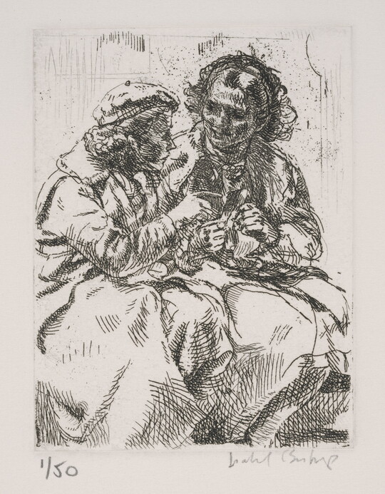
Showing the Snapshot, 1936
Isabel Bishop
Etching
1982.5.1
-
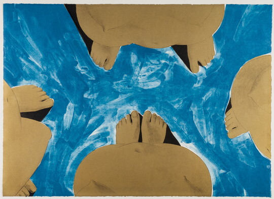
Untitled, 1970
Luchita Hurtado
Lithograph
1970.86
-
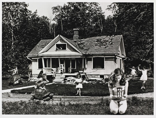
The Time Game, 2011
Jane Hammond
Gelatin silver print
P2011.29
-
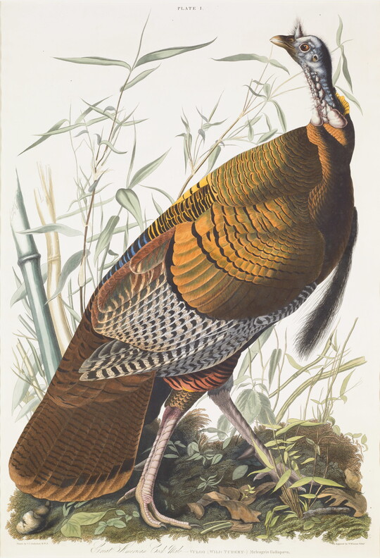
Great American Cock Male-VULGO (WILD TURKEY-) Meleagris Gallopavo, 1826
John James Audubon
Engraving with applied watercolor
1965.24
-
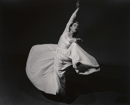
Martha Graham - Letter to the World (Swirl), 1940
Barbara Morgan
Gelatin silver print
P1974.21.17
-
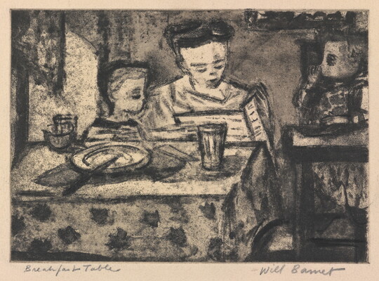
Breakfast Table, 1942
Will Barnet
Etching and aquatint
2011.2
-
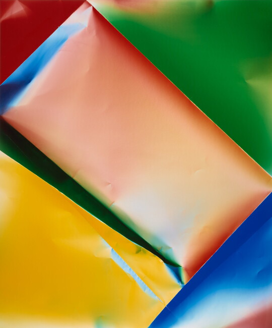
Zerogram, 2017
Ellen Carey
Dye coupler print
P2018.40
-
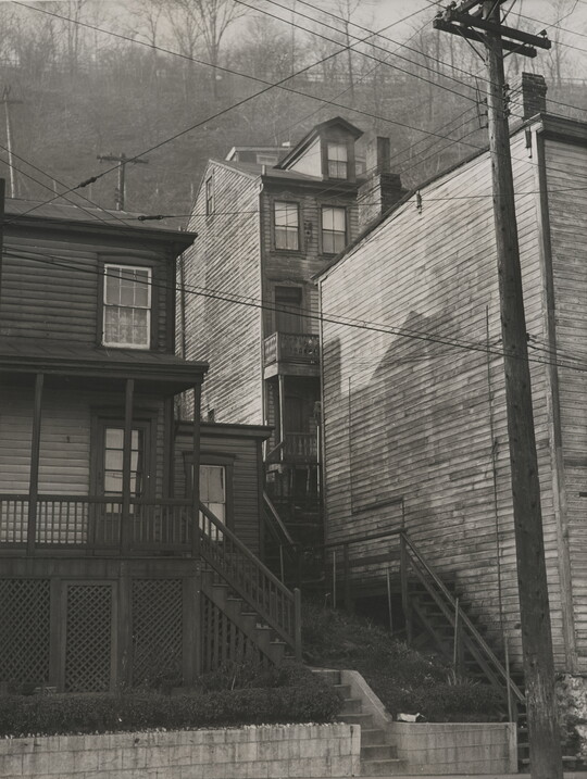
Untitled (Pittsburgh Housing), 1930s
Manuel de Aumente
Gelatin silver print
P2009.11
-
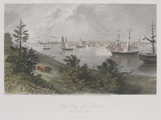
The City of Detroit. (From Canada Shore.), 1872
Asa Coolidge Warren
Steel engraving with applied watercolor
1970.236